Pittsburg County Genealogical and Historical Society, Inc.
E-mail: choctawnationit@sbcglobal.net

31 Land Records & Maps
Training Tool
1
2
3
4
5
6
7
Process/Presentation
Presentation
National Archives Links to cartography, gazetteers, and maps.
Topview
Podcast/Training Courses
Ancestry - Maps: A Path to Your Ancestors - 2012
Ancestry - World Atlas of Genetic Ancestry - 2012
Plat Map - 2008
How to Overlay Plat Maps on Google Earth - 2013
An Introduction to TopoView 2015
Gazetteer
Getty Thesaurus of Geographic Names® Online
Wiki/URL
Cyndi's List
Plat Map
Lot and block survey system
About Land Records
BlogsHandouts
Using Maps in Genealogy
Maps n More OK Genweb
General Land Office Primer
US Military Bounty Land Warrants
Land Records Research Guide
American Indian Land Research Guide
Public Lands - how to plot property on Orginal township/range survey from BLM
10 Cool Things You Can Learn from Deeds
Locating Land Records on the BLM's General Land Office Records Website
Historic Land Ownership Maps and Atlases Online
Digging for Deeds
Land Records Online
Timeline of U.S. Public Land Acts
Books
Lloyd Bockstruck’s, Revolutionary War Bounty Land Grants Awarded by State Governments
The Tobucksy News
What is a Plat Map - 2012 September - Vol. 29 #3
Family History and Maps - 2013 May - Vol. 29 #2
Pittsburg County Map prior to lake Eufaula - 2007 January - Vol. 24 #1
Pittsburg County Map Locations - 2006 September - Vol. 22 #3
State of Oklahoma Map - 2005 May - Vol. 22 #2
Family Tree Magazine
Land Records January 2014 page 33
Maps
USGS
David Rumsey
Sanborn in PCGHS library - need to visit to use
OHS
Lib of Congress
MapWorks - some are free
10,000 Maps in the Oklahoma Historical Society
David Rumsey Map Collection
Maps of United States Indians by State
For fee Databases
Free at Tulsa Library Getting started with HistoryGeo
Mark Lowe Genealogy Subscription Databases
Perryville
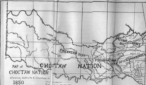
1850
Pittsburg County
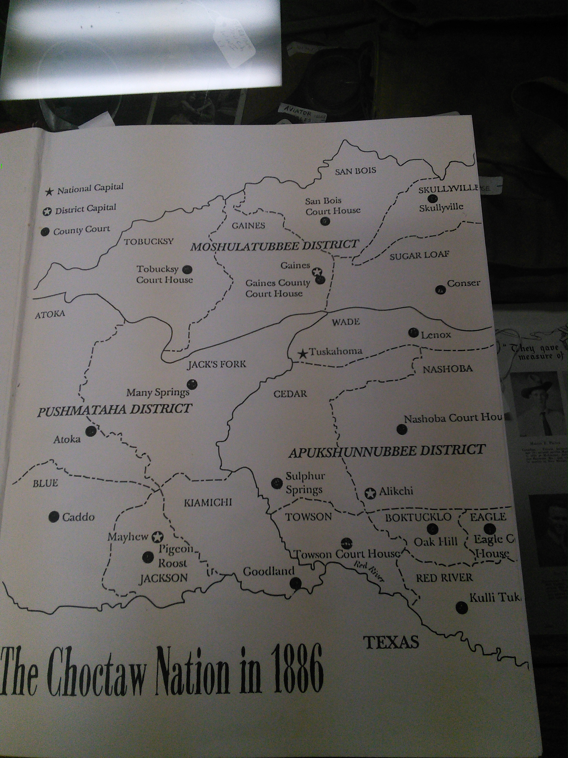
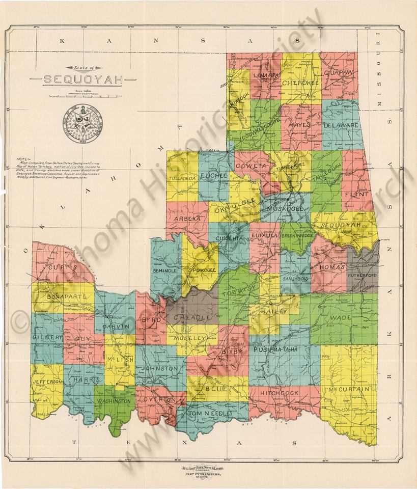
CHOCTAW AREA 1895
Oklahoma Maps from 1915 Atlas
1972 USGS Maps of Counties in Oklahoma
Modern Maps
Matrix
Coal map of the McAlester District, Pittsburg and Latimer Counties, Oklahoma
From Life and Times of the Choctaw Orginal Enrollees
2015 Map
Pittsburg
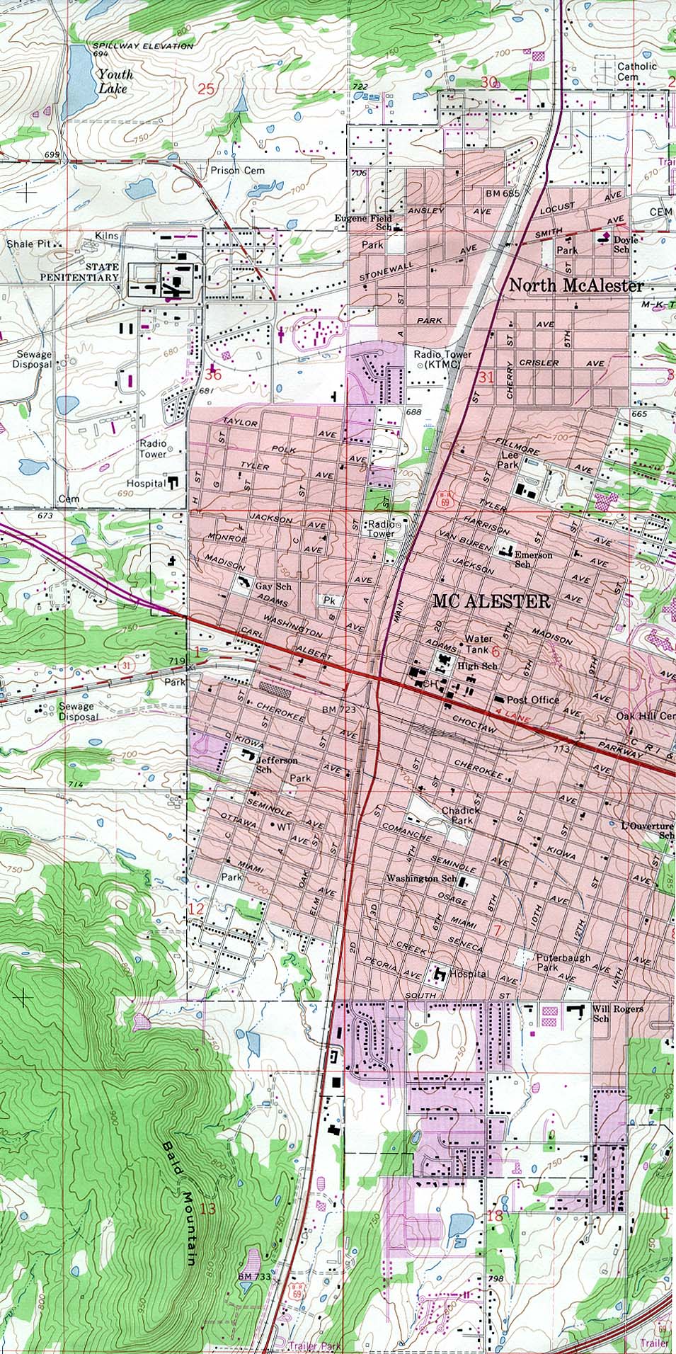
1978 McAlester UT
Cemeteries in Pittsburg Co. OK
Peabody GNIS Service - Oklahoma
Pittsburg Co. Quick Links
1915 RR
1972 USGS
Township
1950 Census ED map
#2 Mcalester specific list wards
Jefferson Highway
Jefferson Highway
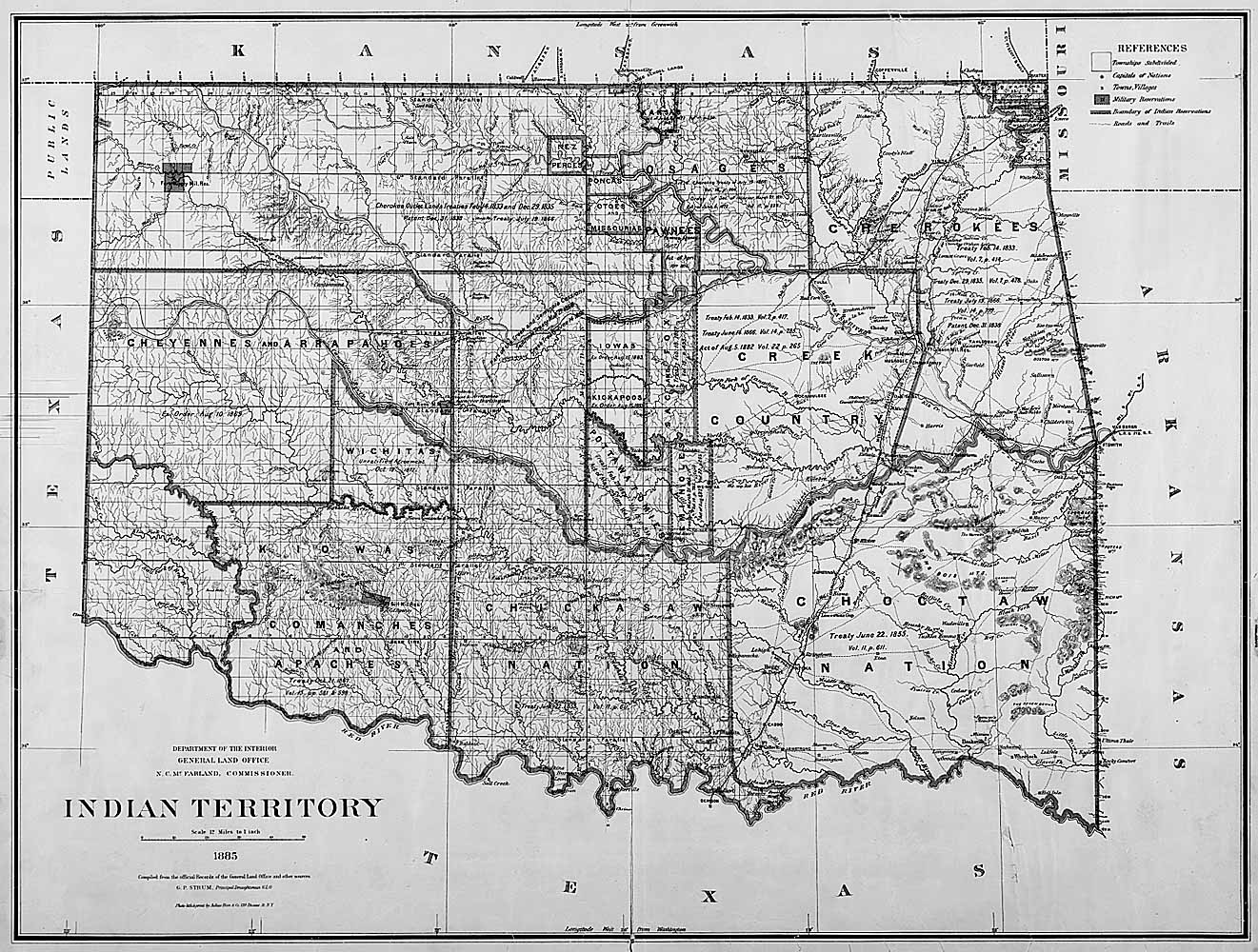
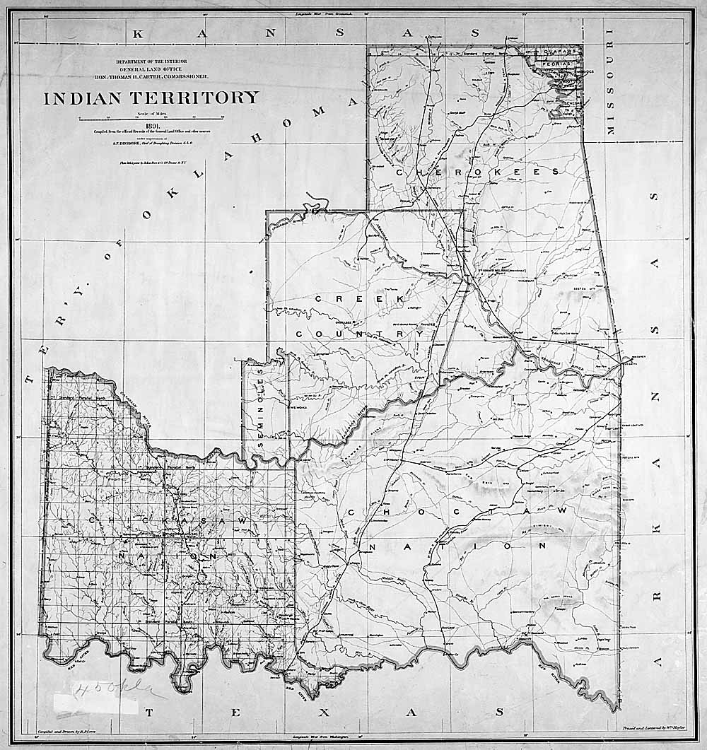
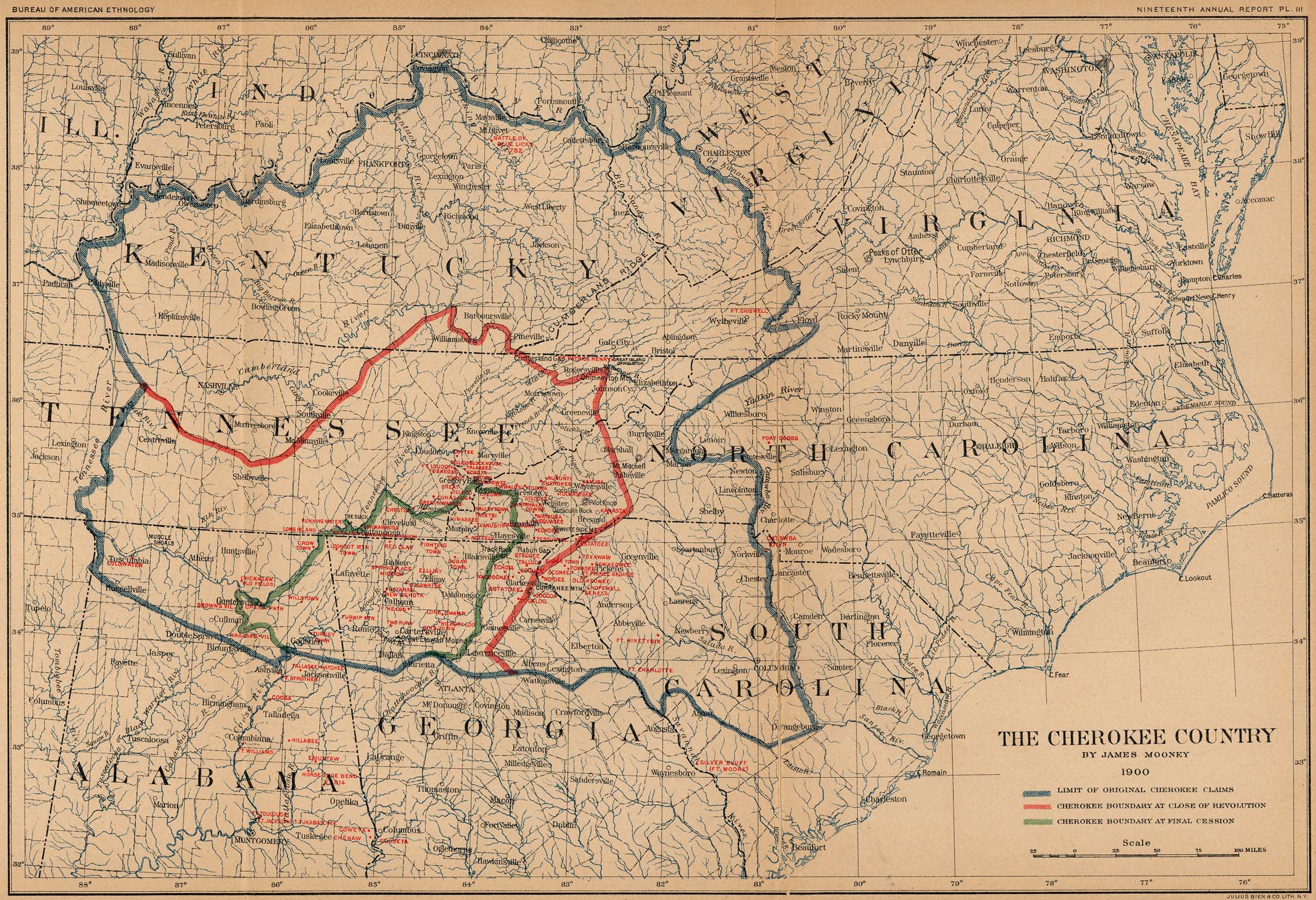
Oklahoma/ Oklahoma Territory/Indian Territory
Gregg,
Josiah, 1806-1850
Indian Territory, Northern T …
1844
Exploration Book
Mitchell,
Samuel Augustus
A New Map of Texas Oregon an …
1846
Pocket Map
1856-66 Oklahoma Map
Book - Oklahoma - A history of the Sooner State by Edwin C. McReynolds
54-10052
p214 Great map
Room 1 PCGHS Library
Books - Oklahoma - Its Origins and Development by Victor E. Harlow 1949
p 176 Map Indian Country during the civil war - Good for Battles
PCGHS Library - 5th edition Room 1